
Statistics:
-| Initial Target: | Worthington, MN |
| Departure: | Worthington, MN 5:00 pm |
| Arrival: | Westchester, IL 3:30 am |
| Intercepts: | Mankato, MN |
| Tornadoes: | 0 |
| Hail:No | Non-Severe (not measured) |
| Wind: | Non-Severe (not measured) |
| Features: | Wall Cloud, HP Precip Core and Gust Front |
| Miles: | 557 |
Summary:
Second day in two day chase trip to Minnesota with Jennifer Brindley Ubl. Waited most of day for initiation with favorable parameters in Worthington, MN where we spent the night from the previous chase. Targeted newly developing cells to the east, intercepting tornado warned supercell west of Mankato. Noted wall cloud and smoke plume tornado look-a-like. Chased storm east of town as it transitioned into HP, and followed other HP cells before breaking off chase at dark, stopping for dinner with other chasers, and driving overnight for home. |
Crew and Equipment:
Chase partners: Jennifer Brindley. Equipment: Kenwood TH-F6A Tribander, Dell Inspiron Laptop. Millenicom 760 USB datacard and cradlepoint router, Holux 236 GPS, Canon 60D and EF-S 10-22mm |
Video:
Details:
Jennifer Brindley Ubl and I were on the second day of a two day run to Minnesota. Wednesday looked like a pretty decent setup with a warm front draped across southern Minnesota and trailing cold front/dryline down in Nebraska. While SPC had highlighted higher tornado probs across Nebraska and southeast South Dakota, I liked our position in Worthington, MN where we had spent the night. Decent speed shear, enhanced helicity on the warm front, and convergence by the triple point looked like a favorable mix of ingredients, and convective models indicated initiation on the warm front as well. |
 |
| We bummed around in some farm fields for most of the day trying to find interesting things to take pictures of and experimenting with cloud time lapsing. We had a nice puffy cumulus field to work with, but convective development seemed like it was on hold. | 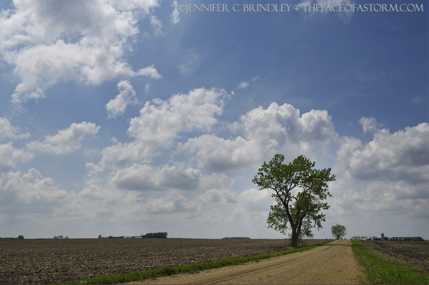 |
| By early evening we finally had initiation to our east along the warm front. We raced after the growing towers, trying to catch up before they could get away from us. |  |
| A supercell developed west of Mankato and quickly picked up a severe warning. Coming into the back end of it we caught a low rainbow in the storm's rain filled wake: |  |
| Now tornado warned, we had a visual on a very low wall cloud as we approached from the southwest on Highway 60 near Lake Crystal, MN. |  |
| We paralleled the wall cloud from the south trying to get ahead of it. As we passed it, Brindley spotted a plume of dust flare up underneath. It was brief, but a circulation spinning up underneath a wall cloud is a tornado. |  |
I missed spotting it while driving but was able to snag it on the dome camera. Here's a labeled screen capture from the video of what we thought we caught: The debris cloud turned out to be smoke from a small fire at nearby farm, interacting with outflow from the rear flanking gust front. Jeremy Den Hartog and others had a visual on it and were able to make out the flames underneath. It sure had us going for awhile though. |
 |
| We cut north east of Lake Crystal and got right in front of the wall cloud, getting ready for what we hoped would be the next tornado. It never developed, however, and before the wall cloud arrived we were blasted with cold outflow, not a good sign for tornado development. |  |
| Keeping ahead of the storm so we wouldn't wind up in the rear flanking core, we stopped off of highway 60 just shy of Mankato, knowing we wouldn't get our view back until we were through town. The storm was now starting to transition into more of a high precipitation mode, but the structure it exhibited was dramatic. |  |
| Sirens wailing in Mankato, the wall cloud approaches: | 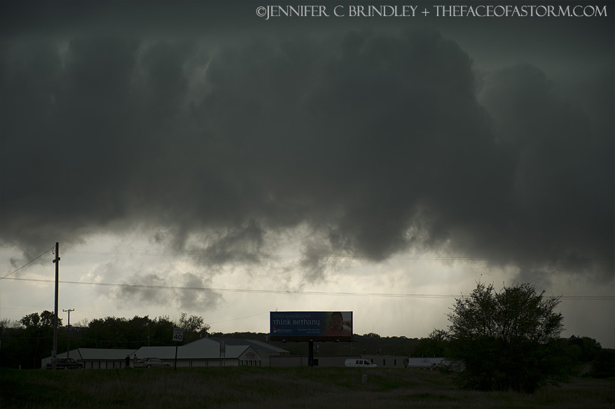 |
| Jon Williamson, Jeremy Degenhart and others caught up with us where we stopped. We chatted for awhile before getting back on 60 to cut through town before the storm hit |  |
| East of town we had to stop for one last shot of the storm, before the rear flanking core completely filled in with rain from merging cells and we lost all view of any structure. | 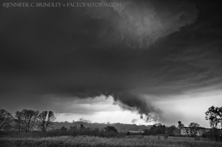 |
| We drifted east for awhile, a few miles south of what was now becoming several training cells. Large gust fronts were fanning out from the storms and I feared the chase might be over. The lead cell was able to reorganize, however, and we cut north by Owatonna to get back into position. | 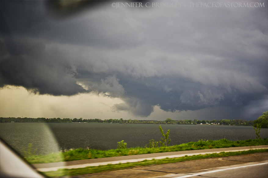 |
| The Storm had beautiful high precipitation structure, and still looked very capable of producing a tornado. | 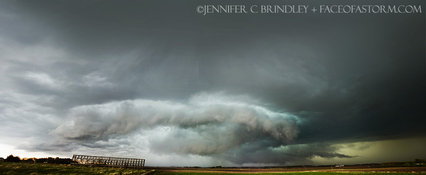 |
This storm was moving quite a bit faster than the last and we were scrambling for awhile trying not to get munched by large hail in the core or a hidden tornado. Looking northeast at the approaching rear flanking core with prominent wall cloud and tail cloud extending off to the north: |
 |
| The great structure didn't last for long, however, and the storm started to look cold and outflowy: | 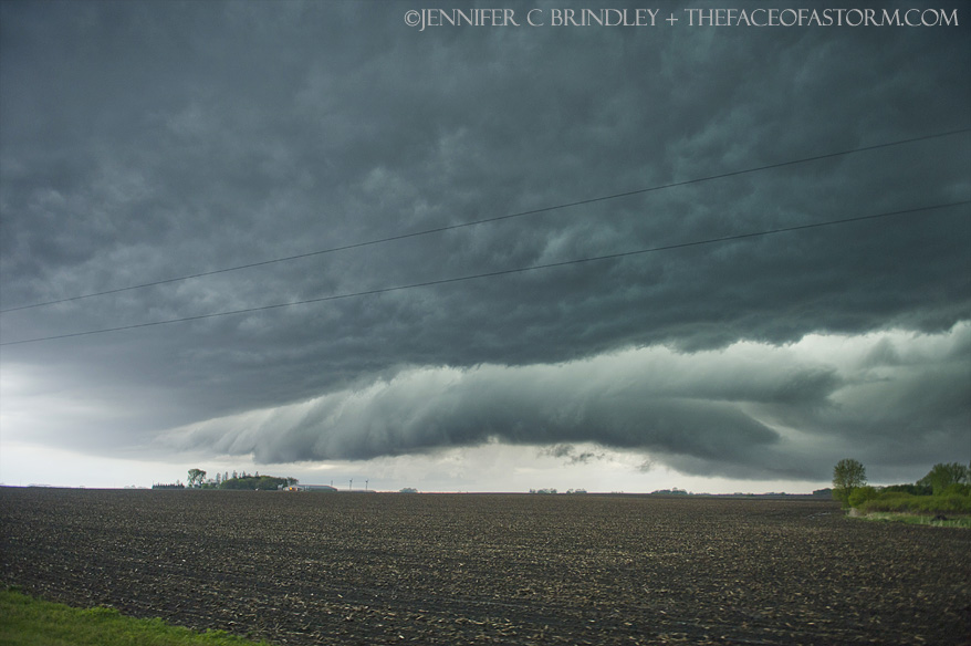 |
| We stair stepped in front of it for quite awhile until finally at dusk the storm had lost its warnings and was fanning out into a series of gust fronts. Jarrod Schoenecker caught up with us and we chatted for awhile before deciding to call it chase and start heading for home. |  |
We stopped at Perkins in Rochester with Jon Williamson and crew for some dinner before making the long overnight drive back to Chicago as I had to be back at work the next morning! |
|
| Conclusion:
This was a fun chase, and while we thought we had a brief, weak tornado initially, it turned out to just be smoke. Still, the great supercell structure we caught made this chase worthwhile. We picked one of the better targets of the day, being on one of the few tornado warned storms anywhere.
|
|
|
Lessons Learned:
|
|
|
|
|

