
June 14, 2016
Statistics
Summary
National Geographic tornado research operations day 16. Upslope play on the Texas Caprock. Targeted Childress area for evening supercells. Intercepted supercell in progress near Truscott, TX noting classic structure and lightning. Storm gradually dissipated by dusk, and headed to Wichita Falls for the night.
Crew and Equipment
Chase partners: Jennifer Brindley Ubl, Anton Seimon, Tracie Seimon, John Allen, Rose Allen, Tim Currie. Equipment: Canon 60D, Canon t2i, Canon EFS 10-22, Canon EF 50mm, Sony FDR-AX100.
Video
Details
"1. Sioux Falls to sw MN: Like the backed winds around the low here and enhanced helicity on the warm front. Significant height falls and cooler temps aloft should make for some negative LIs and fat CAPE that promote robust updrafts and vorticity stretching. Cap is wide open by morning with lots of forcing though so expect a lot of storms and an early show. Storm coverage may hamper a nice tornado play. Logistics probably put this target out of reach for us with Worthington 8 hours away and we'd want to be there by early afternoon.
2. Western Iowa: Storms forming south on a trailing line from the low may cross the Missouri into western Iowa where winds are forecast to back. Moderate to strong instability and ample shear would support supercells. I see less focal points for initiation and discrimination for a tornado play here so it might be kind of a crapshoot.
3. Eastern Kansas: Morning MCS is forecast to track right through Kansas, this may hamper later development across this target, despite the midlevel speed max that's forecast. WInds are badly veered here so I'd expect clusters and splits, problems with storm mode, and a fast motion to the east. Not a big fan of this target at the moment.
5. Texas Panhandle: Capping may be an issue, but very rich moisture is forecast to flow up the Caprock east of Amarillo, with dews approaching 70 making for some extreme instability. Capping may bite down here, with the LSIs only open a crack. But it may be enough, especially given that this target produced on 6/13 (yesterday). Looks like more of a conditional gamble to me and would put us out of play for later targets.
6. North central OK: An elongated surface low is forecast to form in western OK with temps exceeding 90 degrees. Expecting initiation off the nose of this where lapse rates are steep and convective temps are reached. Winds back around this low, and the low level jet is forecast to really ramp ahead of it, making for some rather extreme helicity values. Coupled with strong to extreme instability from the rich moisture, tornado probs are off the charts down here. They of course rely on this surface pattern and wind profiles being realized, and the NAM was off in southwest Kansas on 6/13 (yesterday) so this is something to be skeptical of. Still, the combination of strong instability and very favorable shear makes this an attractive target and currently has my vote. Would opt for a Bartlesville target at about 22z, expecting imitation southwest of there an hour or two earlier. Not the best terrain to chase in, but maybe our best shot at a chaseable tornado, and an easy run up 44 for the Day 2."

" Day 1 Synopsis: A low will push eastwards into NE and IA today, leading to a somewhat widespread severe threat over a large number of areas, including a warm front draping through IA/IL, along the Pacific Front through IA, in the post frontal airmass, along the trailing front in KS (though tempered by morning convective evolution), and into OK. As Skip has alluded too - more targets than you can poke a stick at. I tend to agree with Skip that target 1 is out of reasonable range given the early firing, and widespread storm coverage, and overlying anvil from the MCS yesterday plus convective debris not being handled well by the models will be an issue. Target 2 looks like a crapshoot with marginal shear, a difficulty with initiation and a fairly unlikely tornado play. Target 3 leaves me with no idea how thats going to evolve - maybe it’ll work, maybe it won’t. Shear is all over the shop, and with the environment getting overturned its anyones guess what the shear profile will look like with environment or shear. Target 4 is off the charts, but we won’t talk about that ;). Target 5 is a hope, but a slim hope at best that will have an extreme cap bust probability. As for 6, I was looking at this target yesterday as well, with some really interesting helicity tracks heading toward Joplin, MO, but models have backed off now, and we have elevated weak convection in western OK/southern KS that may or may not play a role. On the plus side - SPC are worried enough to mention it. Given the morning evolution and distances involved, I’m going to lean towards a KS/OK play, and hope that this crap dies out before ruining the environment - certainly a better call for running up I44 tomorrow. In any case we are going to need to be further east than we are now.
Day 2: There looks to be a target in the IL/IN/WI region with reasonable wind backing, ample instability and moisture, with a few discrete cells firing in 4km NAM, while marginal moisture return and questions about even upslope initiation likely to preclude any substantive development in MT and the high plains ND until WAA kicks in.
Day 3: You’d likely need to be in southern Canada (particularly SK) to have any shot of this target, and the SPC is pretty explicit about this. Maybe some stuff into the northern US tier, but its a dicey call."

"After much needed rest and a great breakfast, we set off south. We were targeting the trailing front of the dryline bulge, on the edge of where the previous night’s MCS had tracked through KS and OK, and characterised by moderate to extreme instability of 4500j/kg CAPE and moderate vertical wind shear of 30-40kts, together with a remnant outflow boundary.
Two cells initiated in the Red River Valley nearby Matador TX. The southernmost of these became severe warned, with an LP structure and tops into the 70,000ft range. This prompted the issuance of a tornado watch, only the second of our trip. Displaced further north, we quickly closed toward the storms, observing a second LP to the north of the first, which shrivelled and died on our approach. The southern storm however began to feed on higher levels of moisture, and as we approached, it had a nice structure in the early evening sun.
A second cell generated behind it, but we positioned for the first cell and observed some interesting scud, or potentially smoke plumes from lightning strikes, under the base. The storm however only ever managed weak inflow, likely lowering the tornado threat. Nonetheless, a wall cloud prompted a multi-team PIV deployment, and while the storm did not produce a tornado, the structure was impressive, especially as it was illuminated by the setting sun and later by lightning bolts and anvil crawlers. Owing to our position on the Permian dirt roads and the risk of our vehicle getting stuck in the sticky mud, we relocated back to the main road prior to the rain’s arrival.
We all headed to Wichita Falls for dinner, where team Duck was farewelled for home by the remaining two teams who were headed for northern storms in the days that would follow. Applebees’ lighting proved the best location for our group shot, which turned out perfectly (and is a screenshot because I didn’t know how to shrink it!). For team Duck, it was an amazing expedition, and despite the weather trying its best not to cooperate, we managed to learn a great deal and hone our techniques and approaches for future endeavours to follow. "

Top from left to right: Skip Talbot, Tim Currie, Jennifer Brindley Ubl, Rose Allen, John Allen
Bottom from left to right: Anton Seimon, Jodie, Squire, Tracie Seimon

Conclusion
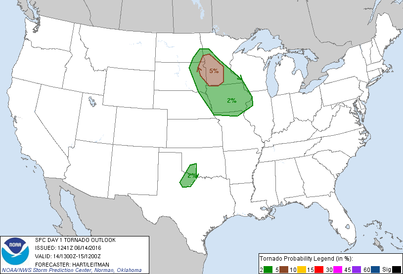
I pulled my hair out trying to hone in on a target on this chase, and my first pick was the best one with tornadoes on the warm front in northeastern SD. We just didn't have the time to make it up there, however. I was torn between southeast Kansas and the Texas Panhandle, and we wound up scoring a super pretty supercell in the Texas Panhandle so that made the chase for us. This was the last chase we had all three teams together for our 2016 tornado research operations.
Lessons Learned
- Watch out for Bobcats on those rural Texas roads.
- Be assertive in your target picking, and stick to it.

Webpage, graphics, photos, and videos © Skip Talbot or respective owner 2018.
skip.talbot@gmail.com Skip's Webzone