May 2, 2018
Statistics
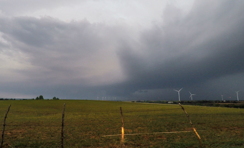
Clay Center, KS 8:30 AM 5/2/2018
Wellington, KS 11:25 PM 5/2/2018
Rotating Wall Cloud, RFD Gust Front
Summary
Dryline play in western and central Oklahoma. Targeted Clinton, OK for afternoon tornadic supercells. Intercepted tornado warned storm that had already produced south of New Cordell and tracked to Canadian River southwest of El Reno noting rotating wall cloud... and lots of bad driving.
Crew and Equipment
Solo chase. Equipment: Sony AX100, Samsung Galaxy S7.
Video
Map
Details
I've grown to loathe chasing Oklahoma over the years. It's overcrowded with reckless thrill seekers, the terrain is overrated, and the storms are often hazy pieces of junk. I decided to make the long haul from northern Kansas, however, hoping to catch a discrete Tail-End-Charlie storm in western or southwestern Oklahoma, away from the hordes that would hopefully be congregating under SPC's moderate risk in southern Kansas.
From Facebook: "Good morning, Kansas! And isn't it a lovely day? Gray, bleak, impending doom in the forecast. This is where I camped out for the night. To hell with the moderate. That's for straight-line winds. I hope you SPC chasers realize that. I thought I was going to be sneaky and play down the dry line, but SPC just bullseyed it on the latest day one tornado outlook. So I'll see all of you suckers down there... again. There was an intersection near Tescott last night that looked like the end scene from Field of Dreams. Just an endless line of cars on the farm grid."
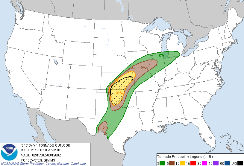
I snaked my way down from northern Kansas to west central Oklahoma, grabbed lunch and then sat in Clinton. I held the line, hemming and hawing about which storm to target as the dryline lit up to the west around Elk City. The north storm started to fizzle and the south one picked up a tornado warning, so the decision was made and I dashed south out of town. South of New Cordell, Highway 183 veers west and my route took me into the forward flank precipitation core of the supercell. In the driving rain, a tan truck with a topper over the bed passed me, uphill in a no-passing zone, and with an oncoming semi.
With more traffic still in the way, the reward for this reckless stunt was being no closer than me to intercepting a high-based, cold, outflow dominant gust front. The storm had apparently produced a legit, yet brief tornado maybe 15 to 20 minutes earlier as seen by Tim Marshall, but it had long since fizzled. I arrived late to the party as a result of commitment issues in Clinton.
I turned east on Highway 9 to stay ahead of the RFD gust front along with throngs of other chasers including a scientific research group with a mobile doppler, probablyTWIRL. A dusty brown gustnado churning away in the field to my southwest was reported as a tornado, but I was almost positive it wasn't a legit tornado. There was no discernible rotation in the gust front above that location, and the storm was barfing cold outflow at that time.
Watching the scuddy gust front pass to my north:
Driving east down Highway 9 took me (and seemingly hundreds of other chasers) through a few towns including Mountain View and Carnegie. A dog darted across the road in front of me. I anticipated it would double back so I hit the brakes.
And it's a good thing the dog actually did turn back because the chaser behind me driving a crossover with an obnoxiously large blue "Storm Chaser" sticker zoomed around me without hesitation. Double yellow, middle of town, with traffic ahead, it was another reckless and futile gesture.
A hazy, high precipitation supercell drifted along north of the highway. A few scattered tornado reports came in on it, but I never saw anything that looked like a tornado, and NWS Norman even withheld re-issuing a tornado warning on it for a time.
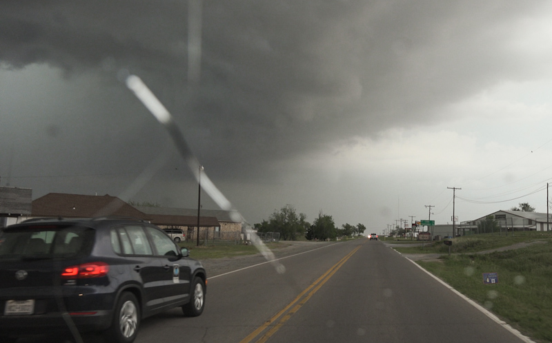
Lots of locals out and about in the shadow of the storm:
Could there be a tornado lurking in there under that lowering? Ah, it's always hard to tell.
"FLASH-BOOM! If the timing on my camera is precise and my back of the envelope calculations are correct, adjusting for conditions at Binger, OK… this bolt struck about 450 feet away. Glad I was in the car, yowzers. " The strike was easily the closest I've been to lightning while on the chase.
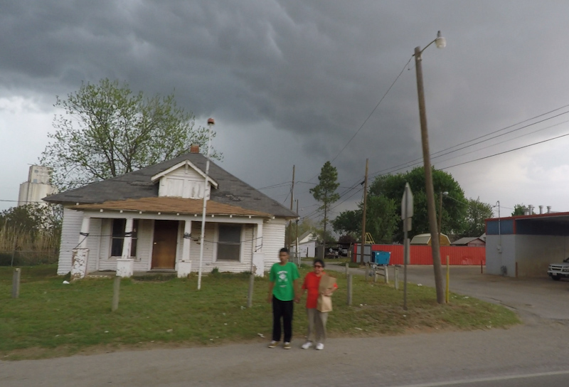
I turned north at Fort Cobb. The coldwar era air-raid sirens wailed in Binger, storm chaser music that sends chills down my spine. I had gained sufficient ground on the storm to stick my nose in the notch and continued north for a peek. A low contrast rear flank downdraft gust front sat on the western horizon with a wall cloud on the north end. A long inflow band stretched off to northeast with a dark forward flank core behind it.
I found a spot with a view north of Cogar, west of Union City, right on the Canadian River. A persistent wall cloud churned away to the southwest. Despite the high precipitation nature of the supercell, I was in a great position for a tornado show, but the storm would not cooperate. Mobile mesonet trucks from the TWIRL project roamed back and forth down the road.
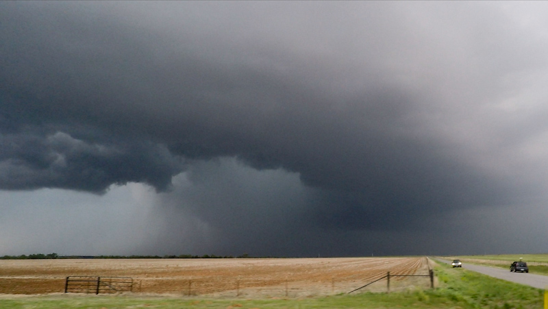
The wall cloud looked like it was trying to wrap up with some moderate rotation for awhile, but alas it couldn't pull off the tube.
The wall drifted by to my immediate south, but it looked like it was starting to get strung out and engulfed in precipitation. The storm was heading toward Canadian and Oklahoma Counties, places I told myself I would no longer be chasing, and given the fading light and slop the storm was becoming, I decided that it was time to call the chase. I took the nearby river crossing north and came out the back side of the storm's forward flank where I was greeted by a golden sunset and mediocre Chinese dinner in a dingy, muggy El Reno strip mall joint. I continued north past Wichita to find a spot to camp for the night to get closer for the third day of chasing.
Conclusion
Despite catching a supercell with some rotation, I'm going to tally this one as a bust. My expectations were a bit higher, I missed a tornado by a few minutes, and the day was otherwise a slog of hazy structure and stressful driving. There were a few enjoyable moments though: the wail of the sirens, the close lightning strike, and a couple moments standing back and watching storms.
Lessons Learned
- Commit to your target storm earlier.
- Chasing Oklahoma is all about defensive driving.